Category:Maps
From Archaelund Wiki
This category contains all content pages (or subpages) and files exclusively containing maps.
Pages in category "Maps"
The following 11 pages are in this category, out of 11 total.
Media in category "Maps"
The following 97 files are in this category, out of 97 total.
 Devil's Horn (mini).png 300 × 300; 129 KB
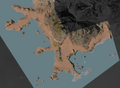
 Devil's Horn by NEUK.png 3,173 × 2,160; 3.67 MB
 Devil's Horn.png 800 × 800; 292 KB
 Emerrand Fort (mini).png 300 × 300; 179 KB
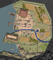
 Emerrand Fort.png 800 × 562; 545 KB
 Galeb Peninsula - Central Area (mini).png 300 × 300; 140 KB
 Galeb Peninsula - Central Area.png 800 × 755; 873 KB
 Galeb Peninsula - Daggerbend (mini).png 300 × 300; 142 KB
 Galeb Peninsula - Daggerbend.png 800 × 735; 826 KB
 Galeb Peninsula - Dead Valley (mini).png 300 × 300; 141 KB
 Galeb Peninsula - Dead Valley.png 800 × 619; 833 KB
 Galeb Peninsula - Eastern Beach (mini).png 300 × 300; 139 KB
 Galeb Peninsula - Eastern Beach.png 800 × 622; 647 KB
 Galeb Peninsula - Galeb's Bluffs (mini).png 300 × 300; 141 KB
 Galeb Peninsula - Galeb's Bluffs.png 800 × 588; 402 KB
 Galeb Peninsula - Mountain Path (mini).png 300 × 300; 140 KB
 Galeb Peninsula - Mountain Path.png 800 × 800; 999 KB
 Galeb Peninsula - Port Galeb (mini).png 300 × 300; 141 KB
 Galeb Peninsula - Port Galeb.png 800 × 573; 652 KB
 Galeb Peninsula - Red Axe Canyon (mini).png 300 × 300; 142 KB
 Galeb Peninsula - Red Axe Canyon.png 800 × 800; 872 KB
 Galeb Peninsula - Urendale Road East (mini).png 300 × 300; 141 KB
 Galeb Peninsula - Urendale Road East.png 800 × 667; 833 KB
 Galeb Peninsula - Urendale Road West (mini).png 300 × 300; 140 KB
 Galeb Peninsula - Urendale Road West.png 800 × 794; 1,011 KB
 Galeb Peninsula - Western Beach (mini).png 300 × 300; 142 KB
 Galeb Peninsula - Western Beach.png 800 × 800; 557 KB
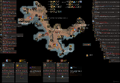
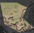
 Galeb Peninsula.png 1,125 × 1,125; 1.28 MB
 Galeb's Bluffs by NEUK.png 3,124 × 2,160; 3.93 MB
 Hall of Justice (mini).png 300 × 300; 205 KB
 Hall of Justice.png 800 × 937; 459 KB
 Harlin Plains - Central Area (mini).png 300 × 300; 204 KB
 Harlin Plains - Central Area.png 800 × 555; 715 KB
 Harlin Plains - Foothills (mini).png 300 × 300; 204 KB
 Harlin Plains - Foothills.png 800 × 771; 863 KB
 Harlin Plains - Irampor (mini).png 300 × 300; 204 KB
 Harlin Plains - Irampor.png 800 × 794; 1,015 KB
 Harlin Plains - Nedolen of Chaggara (mini).png 300 × 300; 204 KB
 Harlin Plains - Nedolen of Chaggara.png 800 × 868; 1.09 MB
 Harlin Plains - Phadabar (mini).png 300 × 300; 204 KB
 Harlin Plains - Phadabar Outskirts (mini).png 300 × 300; 204 KB
 Harlin Plains - Phadabar Outskirts.png 800 × 739; 906 KB
 Harlin Plains - Phadabar.png 800 × 896; 977 KB
 Harlin Plains - Tharkûl Road (mini).png 300 × 300; 203 KB
 Harlin Plains - Tharkûl Road.png 800 × 575; 733 KB
 Harlin Plains - Urendale Road North (mini).png 300 × 300; 203 KB
 Harlin Plains - Urendale Road North.png 800 × 434; 606 KB
 Harlin Plains - Urendale Road South (mini).png 300 × 300; 203 KB
 Harlin Plains - Urendale Road South.png 800 × 411; 526 KB
 Harlin Plains - Western Beach (mini).png 300 × 300; 205 KB
 Harlin Plains - Western Beach.png 800 × 838; 540 KB
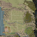 Harlin Plains.png 1,125 × 1,125; 2.6 MB
 Imperial Manor (mini).png 300 × 300; 205 KB
 Imperial Manor.png 800 × 666; 325 KB
 Nessera Caves (mini).png 300 × 300; 130 KB
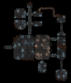
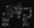
 Nessera Caves.png 800 × 1,289; 655 KB
 Port Galeb Crypt (mini).png 300 × 300; 130 KB
 Port Galeb Crypt.png 800 × 303; 142 KB
 Redaxe Tomb (mini).png 300 × 300; 130 KB
 Redaxe Tomb.png 800 × 652; 126 KB
 Sea Cave (mini).png 300 × 300; 130 KB
 Sea Cave.png 800 × 931; 277 KB
 Shark Grotto (mini).png 300 × 300; 181 KB
 Shark Grotto.png 800 × 800; 397 KB
 The Blue House (mini).png 300 × 300; 205 KB
 The Blue House.png 800 × 800; 171 KB
 Urendale Region - Abandoned Settlement (mini).png 300 × 300; 178 KB
 Urendale Region - Abandoned Settlement.png 800 × 737; 627 KB
 Urendale Region - Emerrand Fortress (mini).png 300 × 300; 178 KB
 Urendale Region - Emerrand Fortress.png 800 × 811; 761 KB
 Urendale Region - Inner Medrin Forest (mini).png 300 × 300; 177 KB
 Urendale Region - Inner Medrin Forest.png 800 × 889; 919 KB
 Urendale Region - Lower Medrin Forest (mini).png 300 × 300; 178 KB
 Urendale Region - Lower Medrin Forest.png 800 × 814; 711 KB
 Urendale Region - Narthis Road (mini).png 300 × 300; 177 KB
 Urendale Region - Narthis Road.png 800 × 371; 405 KB
 Urendale Region - Northern Medrin Forest (mini).png 300 × 300; 177 KB
 Urendale Region - Northern Medrin Forest.png 800 × 407; 436 KB
 Urendale Region - Phadabar Road North (mini).png 300 × 300; 177 KB
 Urendale Region - Phadabar Road North.png 800 × 932; 713 KB
 Urendale Region - Phadabar Road South (mini).png 300 × 300; 177 KB
 Urendale Region - Phadabar Road South.png 800 × 576; 590 KB
 Urendale Region - Port Galeb Road (mini).png 300 × 300; 178 KB
 Urendale Region - Port Galeb Road.png 800 × 815; 619 KB
 Urendale Region - Quarry (mini).png 300 × 300; 178 KB
 Urendale Region - Quarry.png 800 × 641; 559 KB
 Urendale Region - Southern Medrin Forest (mini).png 300 × 300; 176 KB
 Urendale Region - Southern Medrin Forest.png 800 × 808; 796 KB
 Urendale Region - Upper Medrin Forest (mini).png 300 × 300; 176 KB
 Urendale Region - Upper Medrin Forest.png 800 × 813; 808 KB
 Urendale Region - Urendale (mini).png 300 × 300; 178 KB
 Urendale Region - Urendale.png 800 × 936; 822 KB
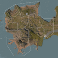
 Urendale Region.png 1,125 × 1,125; 2.14 MB
 World Map (C8).png 300 × 226; 157 KB
 World Map (D7).png 300 × 227; 154 KB
 World Map (D8).png 300 × 227; 154 KB
 World Map.png 1,470 × 1,125; 3.48 MB
.png)


.png)

.png)

.png)

.png)

.png)

.png)

.png)

.png)

.png)

.png)

.png)

.png)


.png)

.png)

.png)

.png)

.png)

.png)
.png)


.png)

.png)

.png)

.png)


.png)

.png)

.png)
.png)

.png)

.png)

.png)

.png)

.png)

.png)

.png)

.png)

.png)

.png)

.png)

.png)

.png)

.png)

.png)

.png)


.png)
.png)
.png)
